

Moderate to Strenuous
The Cotswold Way Walk

The Cotswold Way is one of Britain’s national trails. It is a 102 mile walk along the western side of the Cotswold Hills, running between Chipping Campden in the north to Bath in the south, passing through Broadway, Cleeve Hill, Painswick, and the Stroud Valley, with magnificent views west towards Wales. The route takes you through gorgeous villages close to a number of significant historic landmarks. We can organise this holiday so that you walk the route over 8 to 12 days - the eight day walk has an average mileage of 16 miles, the 12 day walk offers shorter walking days. We can adapt to suit your requirements. Below is the itinerary for a 9 day walk.
Itinerary
Day 1: Arrival Chipping Campden
Take time to explore this charming historic market town with its shops, silversmiths and ‘wool church’. Overnight Chipping Campden.
Day 2:. Chipping Campden to Stanton – (10.5 miles/16.8km)
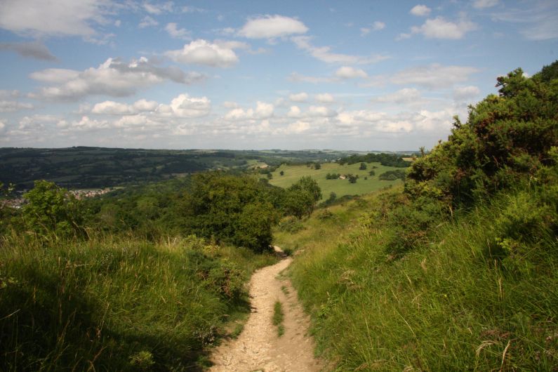
Your Cotswold Way hike continues, departing from the charming village of Chipping Campden, you join the Cotswold Escarpment where you will have gorgeous views to the west as you walk over Dover’s Hill and past Broadway tower. Explore the village of Broadway with its distillery, falconry centre and variety of museums or take a rest before heading to the charming, unspoilt village of Stanton. Transfer to your accommodation at either Toddington or Broadway.
Day 3: Stanton to Cleeve Hill (14 miles/22.5 km)
Today’s route from Stanton takes you through some lovely countryside. Pass Stanway, home to Stanway House, an impressive Jacobean manor house with remarkable gardens and water feature, and then continue on towards Winchcombe passing the ancient remains of Hailes Abbey on the way. From Winchcombe, you climb up Cleeve Hill home to the highest point of The Cotswolds, passing the ancient burial mound of Belas Knap as you go.
Day 4. Cleeve Hill to Birdlip – 15.5 miles (24.5 Km)
Heading south from Cleeve Hill, you are now on the highest part of the entire Trail. The route continues across Cleeve Common with extensive views over Cheltenham and far beyond. The Cotswold Way then passes through Bill Smylie’s butterfly reserve and on to quiet lanes, before starting the descent through Dowdeswell Wood to the reservoir – one of the few places where the native white clawed crayfish can still be found. From Dowdeswell, the Cotswold Way passes through Lineover Wood – a semi-natural broadleaved woodland, notable for its large leaved lime trees and magnificent ‘heritage’ beech. The route then climbs up to Wistley Plantation and on over farmland before descending to pass close to Seven Springs (believed by some to be the source of the Thames). The path then climbs again onto Charlton Kings Common with its breathtaking views across Cheltenham and the Severn Vale and follows the escarpment onto Leckhampton Hill. The National Trail follows quiet tracks, lanes and paths into Crickley Hill Country Park, with its excellent viewpoints and information about the archaeological finds that indicate many periods of occupation. The Trail then crosses the undulating grassland of Barrow Wake before heading into woodland to emerge at Birdlip.
Day 5. Birdlip to Painswick – 7.5 miles (12 Km)
From Birdlip, the Trail passes through magnificent semi-natural beech woodlands and on to Coopers Hill, the site of the annual cheese-rolling event. The route then emerges onto the common land and golf course of Painswick Beacon, where the ramparts of an Iron Age hill fort can be clearly seen. The section then ends in the picturesque town of Painswick, the mid-point of the Cotswold Way. You descend twice as far as you climb on this section, with 590 feet (180 metres) of ascent and 1066 feet (325 metres) of descent. Overnight Painswick, ‘Queen of the Cotswolds.’
Day 6. Painswick to Kings Stanley – 9.5 miles (15 Km)
The Cotswold Way descends from Painswick to cross the Wash Brook before climbing again onto Edge Common – an open area of grassland with views back over Painswick. The Trail then plunges back into woodland emerging at Haresfield Beacon, and Iron Age hill fort with views of the escarpment and River Severn. The route then descends gently through Standish Woods, with beautiful displays of bluebell and wood anemone in the spring, to emerge into the Stroud Valleys through grass pastures. At the Stroudwater Navigation, there is a choice of routes. One option is to take the route alongside the canal and up over Selsley Common, and the other is to head through Kings Stanley. There is more up and down on this section, 1033 feet (315 metres) of ascent and 1082 feet (330 metres) of descent to be precise. Continue through woodland and with open sections revealing sweeping views. Overnight in Kings Stanley, home to the oldest Baptist church in the county.
Day 7: Kings Stanley to Wotton-under-Edge (15 miles/24 km)
Continue your Cotswold adventure as you pass ancient burial sites and hill forts. Explore the small town of Dursley before rejoining the escarpment and climbing steeply up onto Stinchcombe Hill. The best views here are to found by taking the longer route around the perimeter of the hill, as opposed to the shortcut across the neck of the hill from the golf club. The Trail then descends through woodland into farmland and follows a track into the village of North Nibley. From here there is another steep ascent to the Tyndale Monument before the route levels out across grassland and through woodland leading onto Wotton Hill. From a curious walled enclosure surrounding trees planted in 1815 to commemorate the Battle of Waterloo, the Trail then descends into the town of Wotton-Under-Edge. Ascent 835 feet (260 metres), descent 836 feet (255 metres).
Day 8: Wotton-under-Edge to Sodbury (13 miles/21 km)
The walking today is punctuated with many small valleys and streams as far as Hawkesbury Upton, where you leave the escarpment to complete the rest of the day. Passing small villages along the way, this section is pleasantly quiet and fairly easy going the rest of the way to Old Sodbury.
Day 9: Old Sodbury to Cold Ashton (9 miles/15 km)
Depart from the quaint village of Old Sodbury, known for its historic St. John the Baptist Church and charming countryside surroundings. As you leave, enjoy a leisurely walk through the rolling hills and tranquil farmland, with scenic views of the Gloucestershire countryside. Arrive at the peaceful village of Cold Ashton. Explore the striking Cold Ashton Manor, an impressive building dating back to the 16th century, and take in the serene atmosphere of the village.
Day 10: Cold Ashton to Bath (11 miles/17 km)
The final day of walking is predominantly through fields and pastureland and there are some stunning vistas to be had enjoyed before descending into Bath. Highlights include Dyrham Park and there are many interesting memorials and sights along the way. Admire this UNESCO world Heritage site with its attractive regency architecture and rich history dating from the Roman era.
Day 11: Departure
Price:
From £910 (7 nights) to £1,250 (10 nights) based on two people sharing.
Various durations possible (7-11 nights)
Included:
7 to 11 nights nights B and B, luggage transportation, guidebook and maps, transfers where mentioned in programme, back-up service.
Not Included:
Lunches, dinners, drinks, insurance, anything not mentioned in programme.
Departure Dates:
Any day April-October subject to accommodation availability.
Practical Information
Accommodation:
A mix of B and B, pubs and small hotels, with private bathrooms. Up grades are possible along the route – please ask and we can advise on what is possible and the additional cost involved.
Getting There:
Air:
The nearest airports to Chipping Campden are Birmingham, Bristol, or London (Heathrow)
From Bath, Bristol is the nearest airport. Birminham and London Heathrow are also easy to get to.
Rail:
The nearest stations are Moreton-in-Marsh and Cheltenham Spa.
What to Take:
Sturdy walking boots and walking socks (with achange of socks in rucksack), rucksack/day pack, 1 x water bottle with 1 litre capacity, insect repellent, sun glasses, sun hat, sunblock/cream, compass, torch, first-aid kit.
When to Go:
Mid-April to mid-September. Accommodation will be difficult to obtain on UK national holidays unless booked well in advance (and may require an alteration to the programme).
Insurance:
We recommend that you take out appropriate holiday insurance covering you against illness, injury, and loss or damage to luggage. This insurance should also cover the possibility of your having to cancel your holiday for any reason.